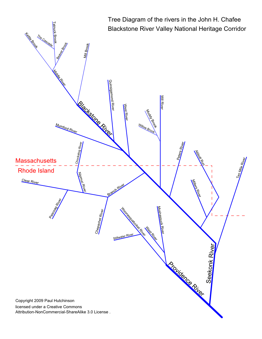
Waterways
Waterways are the core of the Blackstone River Valley National Historical Park. The 22 rivers, Blackstone Canal, numerous streams and brooks drove the industrial revolution and now give many opportunities for recreation. The entire valley drains to the ocean via the Providence River ending at Narragansett Bay. I have entered paths for all the rivers and some brooks that are part of the tour sites into a Google Earth (GE) file you can download here.
I have also created a tree diagram of the BRV waterways containing the rivers and some brooks. The diagram was drawn with Inkscape an excellent open source vector graphics program. There are three versions of the diagram, SVG, PNG and PDF. The SVG version scales the best because it is a vector format also the text and lines are live links to Wikipedia articles about the waterways. If you are using Firefox, or a chromium based browser (Chrome, Edge, etc.), use Ctrl and +/- or Ctrl and a mouse scroll wheel to zoom in and out.
| SVG | PNG | |
|---|---|---|

|
|
|