Blackstone Canal Tour Review
 |
Basic Information | |
| Current Tour PDF | Google Map | |
| Other Tour PDFs | 1997 | |
| 2012 | ||
| When I took the tour | ||
| Tour PDF | 1997 | |
| Date | Sep 2, 2009 | |
| Time | 1:30 pm to 5:45 pm | |
| Walking Distances (miles) | ||
| Basic Tour | 3.7 | |
| See the About page for help |
My Extensions | 0 |
| Parks, Cemeteries & Other | 0 | |
Oops, this page is a work in progress.
You ended up here because I put a live link to this page in another article. I know I should wait and add the link after this page is finished but, I’m too lazy to do it right, sorry. If you’d like me to notify you when this page is finished, contact me and I’ll add you to the notification list.
This walking tour is a nature and history hike through the Blackstone River & Canal Heritage State Park. The trail mostly follows the flat canal towpath making this an easy hike down the valley. The only hilly terrain is the ¾ mile long Goat Hill Trail, where the towpath ends between the lock and Stone Arch Bridge. With much of the route along the edge of wetlands expect some mud and you should be prepared for biting insects. Depending on the time of year there could be mosquitoes, black flies, horse flies or ticks.
There are picnic facilities and canoe access (starting point for a canoe tour) adjacent to the tour trail head. I stopped at one of the many restaurants around Plummer’s Corner to get some food for a picnic lunch before starting the tour.
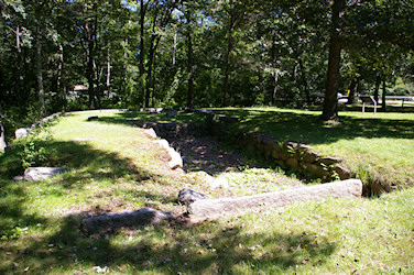
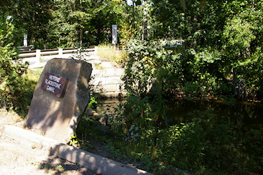
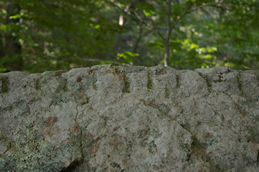
The first site on the tour is across Church Street from the trail entrance, a stop on the Blackstone Canal named Plummer’s Landing. This is an archeological site so please don’t disturb what little remains here. The fieldstone foundation of the trading house, its well, retaining walls for the holding area and a little 19th century broken glass.

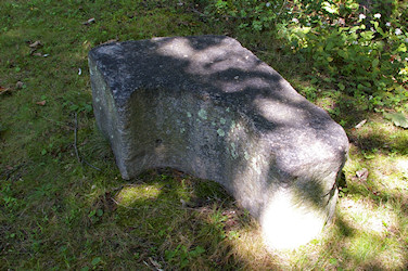
I also spotted what appears to be a gate hinge stone from lock #26 on the grounds. This may be the block mentioned in a 1974 report for the American Canal Society.
I returned in September 2010 to explore the northern section of the towpath. Just after the vernal pool are good views of Plummer’s Landing from the perspective of teamsters working the canal. A tenth of a mile up the towpath is a clearing where a landfill was capped and the adjacent canal section cleaned and restored with private funds. This restoration project is a good example of what the BRVNHC is designed to encourage. If you use the Historical Imagery option in Google Earth you can view the changes this area has undergone since 1995 (the landfill area was overgrown until 2005).
After the restored canal area the trail enters the forest again (0.2 miles) ending at a no trespassing sign before the P&W railroad tracks (0.3 miles). Soon after entering the forest cover I saw a white tailed deer start to cross the trail a hundred yards ahead of me. The doe stopped on the trail and kept her eyes on me while I stood still watching her. As soon as I moved toward her, she jumped across the trail flashing her white tail as she disappeared into the woods. Walking up to where the doe had been I found the river bank only 100 feet north of the trail. A bend in the Blackstone River here gives good access to the bank, I bet this area is regularly crossed by animals on their way to the river.
- Create to do list
- Add info and route for trail from picnic parking to towpath that is not on the official map
- 2nd item
- Final check then build and deploy
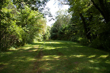
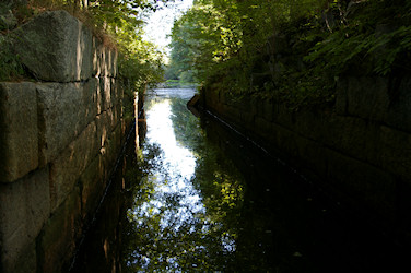
The walking tour continues with a pleasant stroll along the west bank of the canal. There are two alternate paths you can use to start the tour that meet up with Plummer’s Trail about 850 feet from the start. The picnic area trail (see the trail map) leads past some piles of cut stone likely left over from the construction or dismantling of the lock. The third option is to follow the towpath from Church Street, the towpath is a little bit overgrown but it does give a good east side view of the canal remnant.
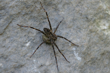
About four tenths of a mile along the trail, where the Blackstone River merges with the canal, I saw this large Grass Spider carrying an egg sac (this version of the photo is scaled to roughly life size).
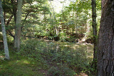
The meandering of the Blackstone along with major floods have cut through the canal towpath allowing the merging of the two waterways. They remain intertwined for a further tenth of a mile along the trail.
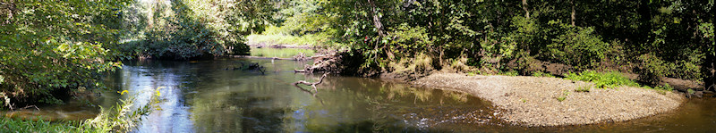
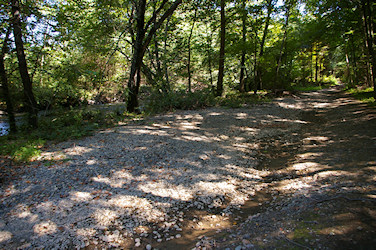
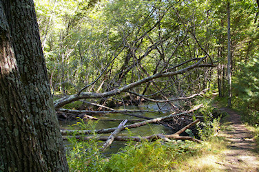
Big floods are a regular although not annual occurrence on the Blackstone. The evidence is all around you on this section of the trail. Trees toppled into and across the river and river rock left high and dry on the inside of river bends and even on the trail.
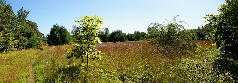
About a quarter mile further along the path is tour site number three, an open field slowly being reclaimed by the surrounding forest. The Harvard Forest web site has a Landscape History of Central New England page that illustrates forest progression from the 17th century to the present.
Finished to here, Click for Photo Timeline
Be careful if you step off the trail to get a closer look at the field’s plants and insects. Poison ivy grows along the forest edges and in expanding patches within the field (lower right of the above panorama).
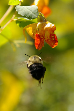
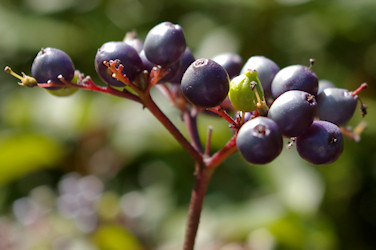
The path through the field is only a little more than a tenth of a mile long, but it was loaded with photo opportunities. Among my favorite photos from here are this Common Eastern Bumble Bee heading for a Jewelweed flower, and the ripe Withe-rod berry clusters that birds had been feasting on.
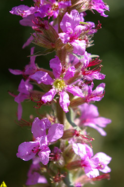
The Purple Loosestrife has a pretty flower but it’s a non-native invasive species that needs to be removed.
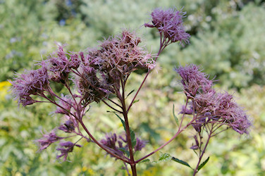
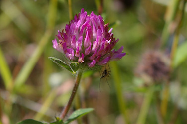
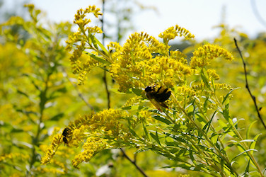
Rounding out my favorite shots are this Spotted Joe-pye Weed, Red Clover with a Mosquito resting in its shade and some Early goldenrod with a Bumble Bee & Wasp harvesting nectar.
I also saw and photographed an American burnweed, Shagbark Hickory, Common milkweed, and a sapling of the Massachusetts state tree, the American Elm.
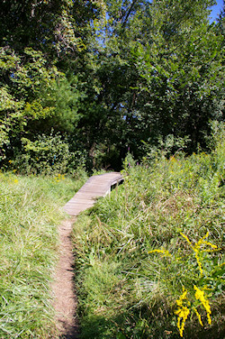
Canal Trail leaving the Open Field
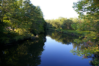
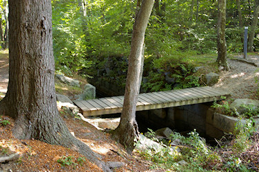
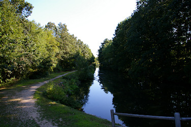
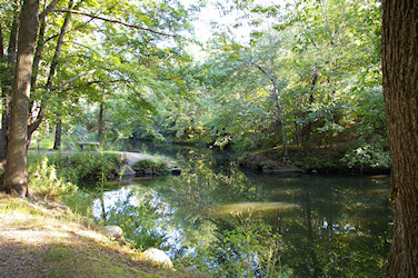
Blackstone River and Canal Trail
Bridges ?
Canal Towpath
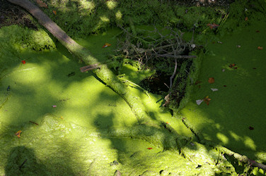
Common Duckweed left high and dry
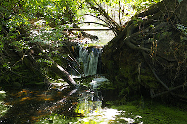
Swamp outlet stream
Swamp west of the Canal Trail
Canal Construction area
Goat Hill was named Goods Hill on USGS topographic maps up to 1943
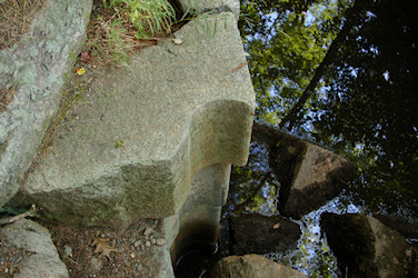
Goat Hill Lock No. 25
Canal Towpath Side trail @ lock to Blackstone River
Goat Hill Trail
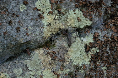
Take lower trail to Abandoned Feathers and Wedges
Blackstone diverges from canal again
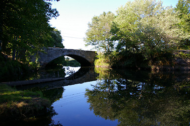
Stone Arch Bridge
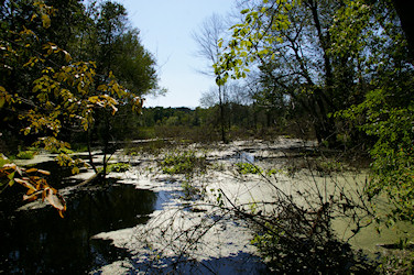
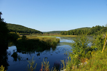
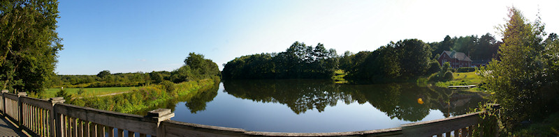
Rice City Pond
King Phillip’s Trail to Lookout Rock
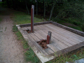
Canal Headgate
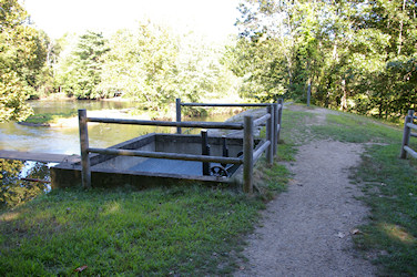
Headgate before reconstruction 9/4/06
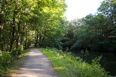
Towpath Trail & Blackstone Canal
Visitor Center Canal Pond
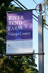
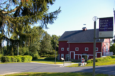
River Bend Farm Visitor Center
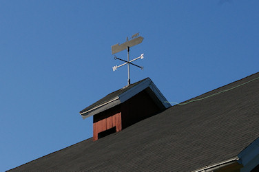
Canal Boat weather vane
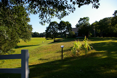
Traditional Mound Plantings and Farmhouse & Field
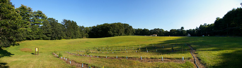
American Chestnut tree farm
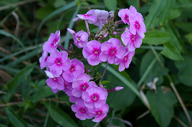
Fall Phlox
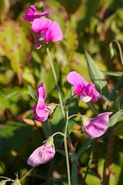
Beach Pea
Blackstone Canal & Towpath
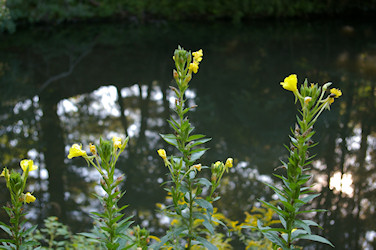
Common evening primrose (Oenothera biennis) 5:07 PM
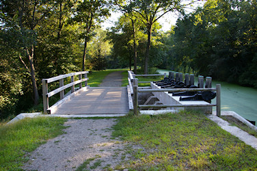
Widow Willard Bridge
Canal Control Gate
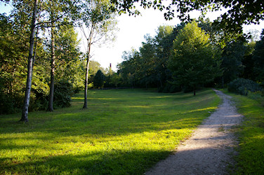
Picnic Field
Steps to the Duckweed covered Canal
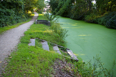
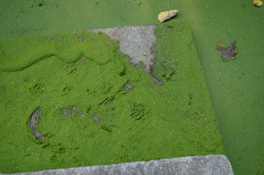
Animal tracks in Duckweed covered Step
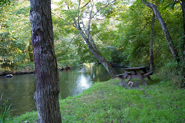
Blackstone River Picnic tables
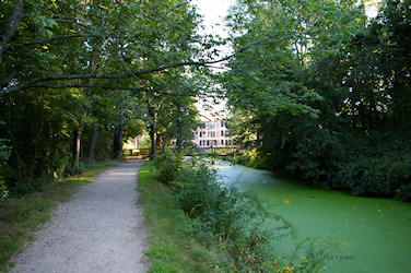
Towpath & Canal covered in Duckweed
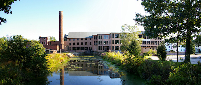
Stanley Woolen Mill & power trench (canal)
Blackstone River upstream of Route 16